Skip to main content
Discover the Thrill of Hiking Table Rock Trail: Where Steep Trails Lead To Higher Truths
Greenville
•9.8/10
•Hard
Discover the Thrill of Hiking Table Rock Trail: Where Steep Trails Lead To Higher Truths
Home/Cities/Discover the Thrill of Hiking Table Rock Trail: Where Steep Trails Lead To Higher Truths
Category
Natural Landmark
Typical Duration
35 minutes
Difficulty
Hard
Photo Gallery
Discover the Thrill of Hiking Table Rock Trail: Where Steep Trails Lead To Higher Truths - Greenville
Discover the Thrill of Hiking Table Rock Trail: Where Steep Trails Lead To Higher Truths - Greenville
Discover the Thrill of Hiking Table Rock Trail: Where Steep Trails Lead To Higher Truths - Greenville
About This Landmark
Table Rock Trail: Where Steep Trails Lead to Higher Truths
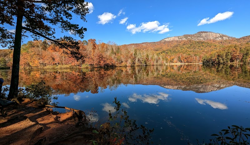
They say that Table Rock Trail in South Carolina is a “moderate hike,” which I imagine means “you’ll reconsider your life choices for about four miles.” This gem of a trail, tucked in the lush Blue Ridge Mountains, is far from a mere woodland stroll—it’s a grueling 7.2-mile out-and-back trek, straight up to the rugged granite plateau that overlooks upstate South Carolina. Hikers who tackle it are rewarded with views that, on a clear day, sweep from dense forest valleys to the distant peaks. Table Rock itself, an iconic rocky outcrop, claws at the sky, giving brave souls a throne-like seat to the natural spectacle below.
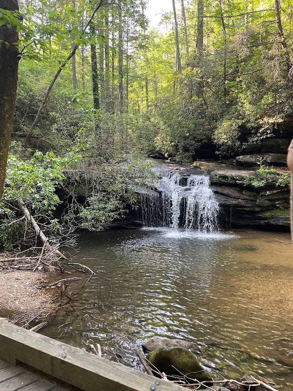
This isn’t a trail that coddles you. From the moment you step onto it, a steep incline greets you, setting the stage for a heart-pumping workout. The first mile weaves through lush foliage and rocky steps, following Carrick Creek, whose cool waters offer a glimpse of the stunning cascades you’ll pass. Every twist and turn reveals the character of the terrain—a mix of twisted roots, rock scrambles, and narrow switchbacks. The tree canopy occasionally parts, teasing you with brief overlooks that only hint at the jaw-dropping vista waiting at the summit.
As the elevation climbs, the air cools, and the rugged path tests every muscle. The trail flattens out briefly at Governor’s Rock, a massive granite slab that serves as a mid-way viewpoint. But the summit? That’s where the true glory lies. Finally, at 3,100 feet, Table Rock’s broad plateau opens up, revealing panoramic views that stretch over the rolling Blue Ridge foothills. After a long, leg-burning journey, the sight feels like a gift.
Prepare for a demanding adventure, but know this: the rewards at the top are well worth every gritty step.
Hiking Table Rock Trail: A Guide for the Determined
Overview:
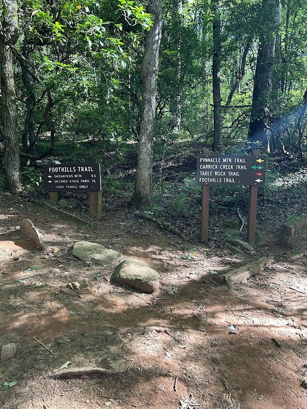
Table Rock Trail, located in Table Rock State Park near Greenville, SC, is one of the most challenging yet popular hikes in the Blue Ridge Mountains. This 7.2-mile round-trip hike offers scenic beauty, rocky terrain, and an unforgettable summit view. The trail begins at Table Rock State Park’s Nature Center, and early risers will find fewer crowds and cooler temperatures for the strenuous ascent.
Key Details:
- Length: 7.2 miles round-trip
- Difficulty: Strenuous, with steep inclines and rock scrambles
- Elevation Gain: Approx. 2,000 feet
- Peak Elevation: 3,100 feet at Table Rock
What to Expect:
- Start of the Trail: Begin at the Nature Center. The trail ascends almost immediately, following Carrick Creek. Look for the cascading waterfall along the creek—a great spot for photos.
- Governor’s Rock: At the halfway point, this exposed granite ledge provides a preview of the views to come.
- Table Rock Summit: The ultimate reward, with breathtaking panoramic views over the foothills and surrounding forests. Bring a camera and lunch, as the summit is an ideal spot for a picnic and a break.
Tips:
- Preparation: This hike is best suited for experienced hikers with good stamina. Bring plenty of water, as the incline is steep and there’s no potable water along the trail.
- Footwear: Boots built for resilience are a must.
- Weather Considerations: Late spring and fall are ideal seasons, as summer temperatures can be intense. Winter hikers should be prepared for icy patches.
Getting There:
From downtown Greenville, head northwest on US-276, which leads directly to Table Rock State Park. The drive is approximately 35 minutes, winding through scenic mountain roads that hint at the adventure ahead. Parking is available at the trailhead, though early arrival is recommended.
Visitor Tips:
- Best Times: Spring and Fall for cooler temperatures and amazing lighting.
- What to Bring: Water, sunscreen, and a camera!
Ratings
Overall
9.8/10User rating
Experience Level
Hard
Experience Needed: This natural landmark is recommended for those with significant outdoor experience. Best for experienced adventurers.