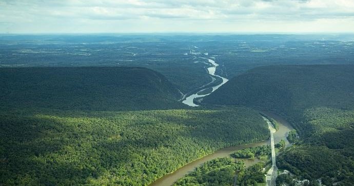
There’s a specific hush that descends over Blairstown in the half-hour before dawn: mist threads the low fields, clouds sit low against the Kittatinny Ridge, and the world is set to be read from above. Pilots and operators value the town for that calm—wide agricultural launch zones, predictable ridge lift in certain seasons, and close proximity to dramatic geological seams like the Delaware Water Gap all combine to make short airborne trips exceptionally scenic and logistically straightforward.
The experience here is intimate rather than epic. Blairstown doesn’t promise transcontinental vistas; it offers a close study of northeastern American landscape: stone walls, farmsteads, river corridors, and the abrupt dark line of the Kittatinny where uplands give way to the sky. That mix is ideal for air experiences that last an hour or two—a sunrise balloon flight that lingers just above the treetops, a 20–40 minute scenic airplane loop for photographers, or a tandem paraglider ride that taps the ridge’s thermals on the right wind day. For travelers, that means opportunities to pair a single early-morning flight with a full day of walking, cycling, or paddling on the ground.
Operationally, Blairstown benefits from being both rural and accessible. Operators typically stage from private fields, community airstrips, or roadside pullouts near ridge takeoff points; they can shuttle guests from town centers with short drives. That accessibility lowers the friction for travelers who want to add an air experience without dedicating a full day to travel logistics. It also concentrates flights into narrow windows—most sorties are scheduled at first light or late afternoon because of thermal activity and local wind patterns—so planning around time slots is part of the rhythm.
Environmental stewardship is a quiet but present part of the picture. Flight paths are generally kept over agricultural land and wide river corridors to minimize disturbance to residential areas and sensitive habitats; operators who work in the region tend to coordinate with landowners and adhere to local guidelines. For visitors, that means privacy during launches and a sense of being welcome rather than intrusive.
Finally, Blairstown’s air activities are naturally complementary to nearby pursuits. Hikers can follow ridgeline trails that parallel paragliding takeoff zones, paddlers can extend a scenic flight into a downstream river day, and photographers can sequence an early flight with a sunrise shoot from a nearby overlook. The net effect is a compact, layered adventure where sky and land feed into one another—perfect for travelers who want both the exhilaration of altitude and the satisfaction of a practical, well-paced itinerary.
Short flights and launches are the norm: operators design experiences that fit into a traveler's day, so expect morning-only windows and swift ground transfers.
The Kittatinny Ridge creates localized lift and wind patterns that skilled pilots use to extend flights, but those same patterns mean routes can change quickly—operators prioritize safety and dynamic planning.
The harbor is the gateway, and the Pacific becomes the classroom.
Blairstown’s rural landscape reduces noise and airspace conflicts, making scenic flights comfortable for photographers, families, and first-time flyers.
Choose by purpose
Whale watching, snorkeling, sunset sailing, cultural canoeing, harbor sightseeing, or private chartering.
Start near the city
Waikiki and Honolulu Harbor are primary hubs, with some trips launching near Hanauma Bay.
Confirm the vessel
Gangways, shaded seating, and boarding requirements vary according to vessel size and operator.