1

Air Tours in Andover, New Jersey

Andover, New Jersey, United States

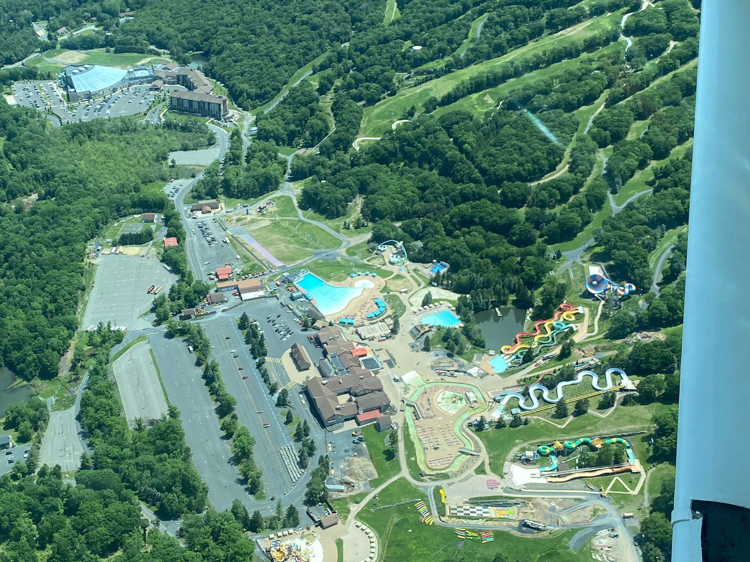
Andover's low-slung skies and patchwork of farmland, lakes, and ridgelines make it an intimate place to experience flight. Short scenic hops from local general aviation fields put the Kittatinny Ridge, High Point panoramas, and autumn color displays within viewable range, while summer and spring flights reveal wetlands, river corridors, and the subtle geology of northwest New Jersey. These air tours are approachable for first-time flyers and rewarding for photographers and outdoor travelers looking to add a bird's-eye perspective to a region usually explored on land.

4
Activities
Seasonal (spring–fall)
Best Months

Top Air Tour Trips in Andover

4 trips • Book with confidence • Instant confirmation

Why Andover Is a Standout Air Tour Destination

There’s a special quiet to northern New Jersey when you lift above it: the patchwork of fields, the narrow silver thread of the Paulins Kill, the ribs of the Kittatinny that run like a spine across the landscape. Andover occupies a sweet spot for the short scenic flight—close enough to small public airstrips that pilots can route meaningful circuits in 30–60 minutes, far enough from dense urban corridors to feel wild. Flying over Andover compresses what this region is: post-glacial terrain folded into ridgelines, kettle ponds and small reservoirs that mirror the sky, and a human scale of towns and farms that animate the valley floors.

Historically, the local aviation culture has been rooted in general aviation and recreational flying rather than large-scale commercial operations, which keeps the flights intimate and flexible. That intimacy is part practical, part poetic: pilots often tailor routes to clients, aiming for pockets of color or carving a line along the ridge for dramatic elevation contrast. For the visitor who spends their time on trails and rivers, an air tour offers a complementary view that reframes familiar places—suddenly a favorite overlook sits within an arm’s-length of a lake, and the interplay of forest and pasture becomes legible as a landscape pattern. Photographers, naturalists, and anyone who enjoys map-making with their eyes will find the perspective indispensable.

Practical advantages make Andover a smart base for air tours. The area’s small airports—easy to reach from regional highways—mean shorter drives before takeoff and more flexible scheduling, particularly on clear mornings and late-afternoon windows when light is best. Seasonally, fall’s foliage peaks draw the most interest for aerial viewing, but spring thaw and early-summer green-up also offer strong visual contrasts, especially after heavy rains when river channels and wetlands stand out. Beyond pure sightseeing, air tours here frequently pair well with other local activities: land a short drive from trailheads for a ridge walk, follow a scenic flight with a paddling session on nearby lakes and rivers, or combine an aerial photography booking with a ground-based photo workshop. In a region defined by varied terrain rather than by a single dramatic landmark, the air tour stitches together multiple vistas into a coherent, memorable experience.

Short duration, high payoff: Many flights are designed as 30–60 minute circuits that maximize visible features without requiring long commitments or complex logistics.

Seasonal highlights: Fall foliage produces the most dramatic aerial tapestry, while late spring brings bright green contrast and migratory bird activity along river corridors.

Local launch points: General aviation fields near Andover enable early departures and private scheduling—ideal for sunrise or golden-hour flights.

Complementary adventures: Pair flights with hiking on nearby ridgelines, paddling on local waters, or a photography-focused itinerary for a layered outdoor experience.

Activity focus: Scenic and photography-oriented air tours
Typical flight duration: Short hops (30–90 minutes) common in the area
Primary visual draws: Kittatinny Ridge, river valleys, lakes, agricultural mosaics
Accessibility: Flights launch from small GA fields; some accessibility limitations for those with mobility challenges
Great for: First-time flyers, photographers, couples, and travelers seeking a compact aerial experience

Best Time to Visit

Best Months

MayJuneSeptemberOctober

Weather Notes

Clear, calm mornings and late afternoons provide the best visibility and smoother air. Summer afternoons can produce thermal activity and scattered clouds; fall offers crisp visibility but can bring windier ridge conditions. Check local weather and aviation-specific forecasts (e.g., visibility, winds aloft) before booking.

Peak Season

Late September through mid-October for peak fall color and highest demand for flights.

Off-Season Opportunities

Late winter and early spring can offer stark, graphic landscapes with snow and open water patterns; fewer operators run regular tours, but private charters are sometimes available on clear days.

Frequently Asked Questions

Do air tours require special permits?

Most scenic flights from local general aviation fields operate under standard FAA rules and do not require separate permits for passengers. If a flight plans to land on private property or a restricted field, additional permissions may be necessary—confirm with the operator.

How long are typical air tours around Andover?

Many regional scenic flights are 30–60 minutes, but operators can offer extended photo charters or custom routes that last 90 minutes or more. Ask for a proposed route and duration when booking.

Are air tours family-friendly?

Yes—short flights are suitable for most ages, though infants and very young children should be secured and may require special seating. Motion sensitivity affects some passengers; bringing a light snack and considering motion-sickness medication can help.

Choose Your Experience Level

Beginner

Ideal for first-time flyers and those who want a quick scenic perspective without complex logistics.

  • Short scenic circuit over Paulins Kill valley
  • Golden-hour ridge pass along the Kittatinny
  • Introductory aerial photography session

Intermediate

Longer flights and targeted photo charters that focus on composition, wildlife spotting, or combined air-and-ground itineraries.

  • Extended photo charter timed for peak foliage
  • Mix-and-match flight plus guided ground hike
  • Aerial survey of local waters and wetlands

Advanced

Custom charters for professional photographers, researchers, or pilots seeking complex routing and specialized shooting conditions.

  • Sunrise-to-sunrise light-session for commercial photography
  • Low-altitude passes coordinated for specific landscape shots (operator-dependent)
  • Aerial reconnaissance for environmental or land-use study

Insider Tips & Local Knowledge

Confirm logistics with operators well in advance—flight windows are weather-dependent and small airfields can shift schedules quickly.

Book early for fall foliage dates and request a morning or late-afternoon slot for the best light. When photographing, sit on the side of the aircraft that faces the ridge or the direction of travel for optimal composition, and ask the pilot in advance about window positions and door/window rules. Keep expectations realistic: small-aircraft rides offer intimate views but can be bumpier than larger tours; if you’re prone to motion sickness, plan accordingly. Finally, pair your flight with a local ground activity—trail hikes, a lakeside picnic, or a paddling session—so the aerial perspective becomes part of a fuller day outdoors.

What to Bring

Essential

  • Government-issued photo ID (required at many airfields)
  • Camera with a short to medium telephoto lens or high-quality smartphone
  • Sunglasses and sunscreen
  • Layered outerwear—cockpit temperatures can be cool even on warm days
  • Any required medications and motion-sickness remedies

Recommended

  • Noise-cancelling or in-ear ear protection
  • A small day pack for gear and quick access items
  • Polarizing filter for photography to reduce glare on water
  • Binoculars for scouting wildlife from altitude

Optional

  • Light tripod or camera grip for steady shots (if allowed by operator)
  • Notebook or sketchbook for landscape notes
  • Reference map or offline map app to follow the route

Ready for Your Air Tour Adventure?

Browse 4 verified trips in Andover with instant booking

Explore Top 15 Andover, New Jersey, United States Adventures →