Skip to main content
A Cyclist's Guide to the Catawba River Greenway Near Charlotte
Charlotte
•Easy
A Cyclist's Guide to the Catawba River Greenway Near Charlotte
Category
Natural Landmark
Typical Duration
25 minutes
Difficulty
Easy
Photo Gallery
A Cyclist's Guide to the Catawba River Greenway Near Charlotte - Charlotte
A Cyclist's Guide to the Catawba River Greenway Near Charlotte - Charlotte
About This Landmark
Cyclist's Guide to the Catawba River Greenway Near Charlotte
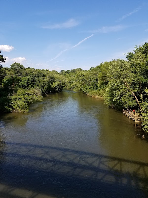
Picture this: sunrise over the Catawba River, a quiet ribbon winding through the morning mist as cyclists gather, stretching and snapping on helmets. The Catawba River Greenway near Charlotte is an under-the-radar gem, offering riders of all levels a blend of city convenience and scenic riverside charm. This trail is more than just a place to ride; it’s a journey from the city’s energy into North Carolina’s lush riverscape, with each pedal stroke carrying you deeper into a world of gentle water, whispering trees, and birdsong.
Starting in Mount Holly, the Greenway stretches southward, following the Catawba as it meanders toward Lake Wylie. It’s an accessible route for all cyclists, with wide, paved paths that stay mostly flat, accented by rolling hills and gentle curves to keep the ride lively. For seasoned cyclists, it’s a great place to maintain a steady pace and cover some distance, while newer riders can enjoy a safe, scenic experience.
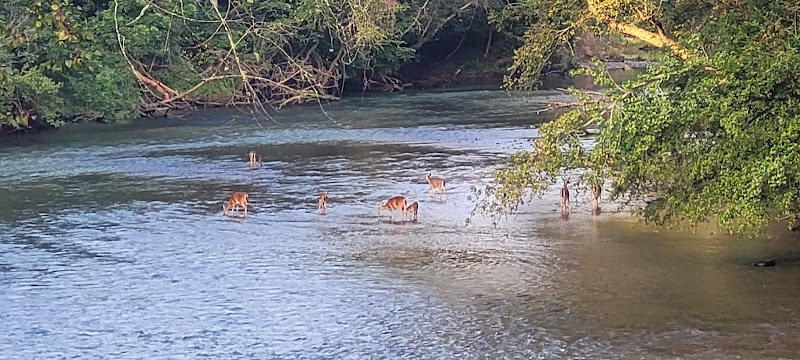
Notable stops include the Tailrace Marina, a beloved waypoint for cyclists. Here, you can grab a sandwich or iced coffee and relax by the river before heading back out. Further along, you’ll find Catawba Riverfront Park, where locals fish, families picnic, and bald eagles occasionally soar overhead. This park is a lovely spot to take a break, with benches and shaded areas perfect for a breather or photo op.
For those seeking a longer ride, continue toward Lake Wylie, where the Greenway merges with other local trails, offering a network of routes to explore. When you’re ready to loop back, let the smooth path guide you, taking in the soft sounds of the river, the rustle of leaves, and the hum of your wheels—a rhythm that helps the city fade and nature take center stage.
The Catawba River Greenway is more than a ride; it’s a tranquil retreat, a place where Charlotte’s skyline fades, and the river’s quiet magic unfolds.
Adventure Guide Summary: Cycling the Catawba River Greenway Near Charlotte
Getting Started
The Catawba River Greenway trailhead is located near Mount Holly, about a 25-minute drive from Charlotte. Begin at North End Access near Mountain Island Lake, where there’s ample parking, marking the start of your riverside adventure. This location offers an easy escape from city life into a peaceful, tree-lined path.
Route Highlights
-
Trail Details:
- Roughly 6 miles of paved, well-maintained paths.
- Great for all skill levels, with a mostly flat route and gentle inclines.
- Multi-use trail shared with walkers and joggers, so stay alert along the way.
-
Stops Along the Way:
- Tailrace Marina: Halfway down the trail, this marina is a perfect stop for snacks, drinks, and a river view.
- Catawba Riverfront Park: Ideal for a break, with picnic tables, benches, and occasional sightings of herons and bald eagles.
-
Extensions:
- The trail links to nearby paths, allowing cyclists to extend their ride toward Lake Wylie for varied scenery and routes.
Insider Tips
- Best Times to Ride: Early morning offers cooler temperatures and fewer crowds, ideal for a peaceful ride.
- Safety: Wear bright clothing for visibility on shaded curves and narrower bridges.
- Facilities: Restrooms and water are available at key access points, including Tailrace Marina.
Directions from Charlotte
Head south on I-85 toward Mount Holly, then follow signs for Mountain Island Lake to reach the North End Access point. This route takes roughly 25 minutes, making it an easy escape for Charlotte cyclists seeking a riverside ride.
Visitor Tips:
- Best Times: Spring and Fall for cooler temperatures and amazing lighting.
- What to Bring: Water, sunscreen, and a camera!
Ratings
Overall
9.3/10User rating
Experience Level
Easy
Experience Needed: This natural landmark is recommended for those with minimal outdoor experience. Perfect for families and beginners.