Skip to main content
Hiking the Majestic Shores: Casque Isles Trail
Explore the 53 km Casque Isles Trail in Terrace Bay, Ontario. This challenging trail offers stunning views of Lake Superior's north shore, with rugged cliffs and serene beaches. Ideal for experienced hikers and nature photographers, best visited in spring and fall.
Casque Isles Hiking Trail - Terrace Bay
•8.4/10
•Hard
Hiking the Majestic Shores: Casque Isles Trail
Category
Hiking
Typical Duration
18-27 hours
Difficulty
Hard
Photo Gallery
Hiking the Majestic Shores: Casque Isles Trail - Casque Isles Hiking Trail - Terrace Bay
Hiking the Majestic Shores: Casque Isles Trail - Casque Isles Hiking Trail - Terrace Bay
Hiking the Majestic Shores: Casque Isles Trail - Casque Isles Hiking Trail - Terrace Bay
About This Landmark
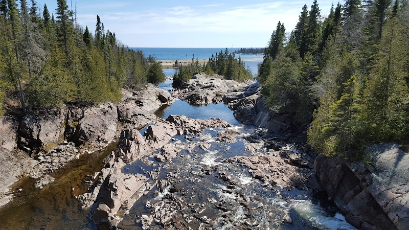
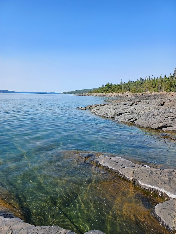
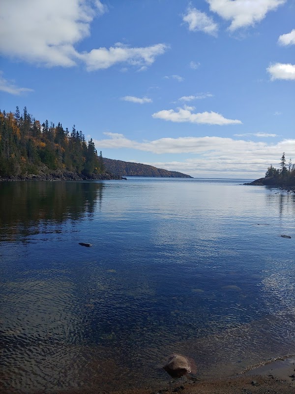
The Casque Isles Hiking Trail in Terrace Bay, Ontario, is a magnificent destination for outdoor enthusiasts seeking adventure along the stunning north shore of Lake Superior. This trail stretches 53 kilometers, weaving through some of Canada’s most breathtaking landscapes. The unique geography of the area combines rugged cliffs, serene beaches, and dense forests, offering hikers a diverse experience. The trail features captivating views of the lake's azure waters, along with chances to encounter local wildlife such as black bears and moose. Originally used by Indigenous peoples and fur traders, the trail is rich in cultural and historical significance. Three main sections, Worthington Bay, Mount Gwynne, and Schreiber Channel, provide distinct experiences, each with its own challenges and rewards.
Adventure Guide to Casque Isles Hiking Trail - Terrace Bay
1. Worthington Bay Trailhead
- Special Features: Stunning coastal sights filled with dramatic cliffs and secluded beaches.
- Local Insights: Known for its quiet beauty, this section offers spectacular views of the lake and is a perfect spot for birdwatching.
- Visitor Tips: Best visited in late spring and early autumn when the weather is mild. Be sure to wear sturdy boots for rocky paths.
2. Mount Gwynne
- What Makes It Special: A challenging section of the trail known for its elevation changes and panoramic views.
- Key Features: Offers a vigorous workout and rewards with sweeping vistas from the summit.
- Visitor Tips: Carry plenty of water and energy snacks, as the elevation can be demanding. Early mornings provide the best conditions for climbing.
3. Schreiber Channel
- Highlights: A more accessible section with trails that cut through lush forests and open onto beautiful sandy beaches.
- Local Insights: This part of the trail is rich in bird species, making it ideal for nature photography.
- Visitor Tips: Bring a camera and binoculars, and consider camping overnight in designated areas to fully enjoy the natural beauty. The trail is a 14 km drive (about 15 minutes) east from the town of Schreiber.
Practical Advice:
- Best Times to Visit: Late spring to early fall for optimal weather and trail conditions.
- What to Bring: Weather-appropriate clothing, hiking boots, camera, sunscreen.
- Driving Directions: From Terrace Bay, take ON-17 E for about 12 km towards Schreiber—a 10-minute drive.
Ratings
Overall
8.4/10User rating
Photography
8.0/10Scenic value
Featured Activities
Primary Activity
Hiking
Also Great For
Birding
Nature Photography
Essential Information
Nearby City
Schreiber, Ontario
Protected Areas
Lake Superior National Marine Conservation Area
Experience Level
Hard
Experience Needed: This natural landmark is recommended for those with significant outdoor experience. Best for experienced adventurers.