Skip to main content
Journey to the Summit: Hiking the Oyster Dome Trail near Bellingham
Hike the 5-mile Oyster Dome Trail near Bellingham, WA. Generally considered a hard route with a steep ascent and 1,050 feet of elevation gain. The views from the top are worth the effort. Busy in summer months, it's a favorite for adventure-seekers.
5 Mi Blanchard Hilltrail
•7.5/10
•Hard
Journey to the Summit: Hiking the Oyster Dome Trail near Bellingham
Home/Cities/Bellingham, Washington/Journey to the Summit: Hiking the Oyster Dome Trail near Bellingham
Category
Hiking
Typical Duration
25 minutes
Difficulty
Hard
Photo Gallery
Journey to the Summit: Hiking the Oyster Dome Trail near Bellingham - 5 Mi Blanchard Hilltrail
Journey to the Summit: Hiking the Oyster Dome Trail near Bellingham - 5 Mi Blanchard Hilltrail
Journey to the Summit: Hiking the Oyster Dome Trail near Bellingham - 5 Mi Blanchard Hilltrail
About This Landmark
Journey to the Summit: Hiking the Oyster Dome Trail
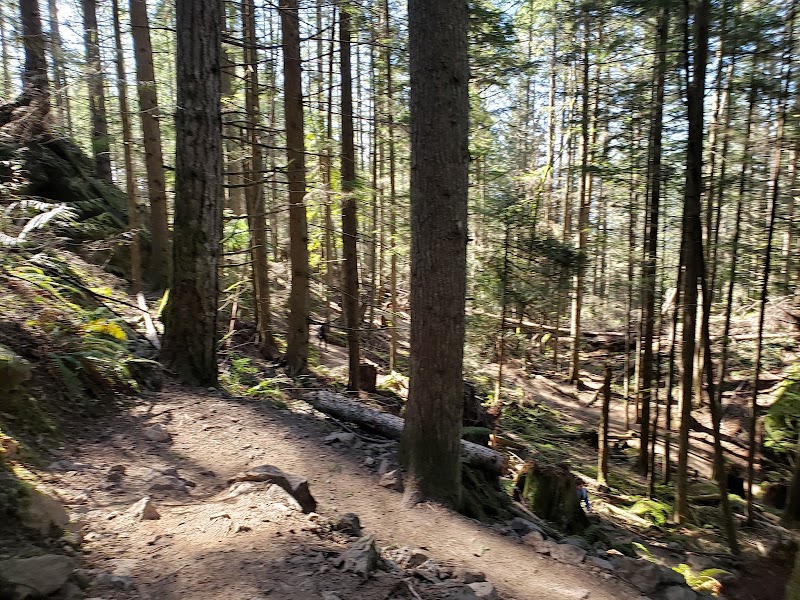
On the edge of the Pacific Northwest, where the sky broods in endless shades of grey and the forests hum with ancient life, lies a trail that calls to the adventurous spirit. The Oyster Dome Trail near Bellingham, Washington, is not just a hike; it’s a pilgrimage to the altar of nature. Towering trees guard the path, their moss-laden branches whispering secrets of the earth’s oldest stories.
The journey begins humbly enough, a gravel trailhead off Chuckanut Drive, but it quickly transforms into a relentless ascent. Your legs burn, your heart pounds, and your resolve is tested by steep switchbacks. Yet, each step up this woodland stairway is a pact—a promise of breathtaking rewards.
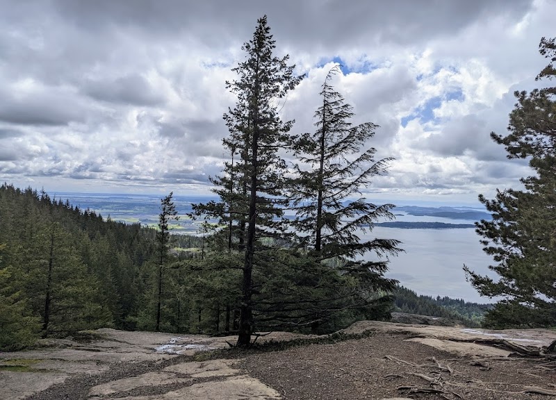
Halfway up, the Samish Overlook offers a breather. Pause here to drink in the view: a sprawling patchwork of farmland stretching to the shimmering waters of Samish Bay. But don't linger too long; the real prize awaits higher still.
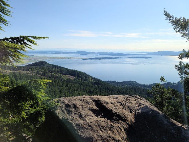
At last, the trail relents, and the summit reveals itself. The Oyster Dome juts out like a ship's prow, its rocky expanse offering panoramic views of the San Juan Islands floating on a glassy sea. If you're lucky, the sun breaks through the clouds, bathing the landscape in a golden glow. It's the kind of beauty that makes you feel small, yet profoundly connected to the universe.
But this hike isn't just about reaching the top. It’s the camaraderie of fellow hikers, the cool mist on your skin, and the moments of silence where the world narrows to the crunch of boots on soil. The Oyster Dome is a reminder that the journey is as transformative as the destination.
For those ready to test their mettle and reconnect with the raw splendor of the Pacific Northwest, this trail is a siren song you can't ignore.
Adventure Guide: Oyster Dome Trail
Overview
- Trailhead Location: Off Chuckanut Drive, just south of Bellingham.
- Trail Length: Approximately 5 miles round trip.
- Elevation Gain: 1,050 feet – expect a strenuous climb.
What to Know Before You Go
- Parking: Limited spaces at the trailhead. Arrive early, especially on weekends.
- Permits: Discover Pass required for parking.
- Trail Conditions: Typically muddy after rain; wear sturdy, waterproof boots.
Route Highlights
- Samish Overlook: A perfect midway point with stunning views of farmland and bay.
- Oyster Dome Summit: The crowning jewel with 180-degree views of the San Juan Islands and Puget Sound.
Tips for a Great Experience
- Start early to avoid crowds and catch sunrise views.
- Bring layers; the weather can shift quickly in the Pacific Northwest.
- Carry plenty of water and snacks; the climb is intense.
Driving Directions
From Bellingham, take Chuckanut Drive south for about 9 miles to the trailhead. Allow 20–25 minutes of scenic driving time.
Whether you're chasing a personal best or simply craving a reconnection with the untamed outdoors, the Oyster Dome Trail promises both challenge and reward in spades.
Visitor Tips:
- Best Times: Spring and Fall for cooler temperatures and amazing lighting.
- What to Bring: Water, sunscreen, and a camera!
Ratings
Overall
7.5/10User rating
Photography
8.0/10Scenic value
Featured Activities
Primary Activity
Hiking
Also Great For
Essential Information
Nearby City
Bellingham, Washington
Protected Areas
Experience Level
Hard
Experience Needed: This natural landmark is recommended for those with significant outdoor experience. Best for experienced adventurers.