Skip to main content
Mount Mitchell Summit Trail: Touching the Sky in Asheville, NC
Asheville
•9.8/10
•Easy
Mount Mitchell Summit Trail: Touching the Sky in Asheville, NC
Category
Natural Landmark
Typical Duration
1 hour
Difficulty
Easy
Photo Gallery
Mount Mitchell Summit Trail: Touching the Sky in Asheville, NC - Asheville
Mount Mitchell Summit Trail: Touching the Sky in Asheville, NC - Asheville
Mount Mitchell Summit Trail: Touching the Sky in Asheville, NC - Asheville
About This Landmark
Mount Mitchell Summit Trail: Touching the Sky in Asheville, NC
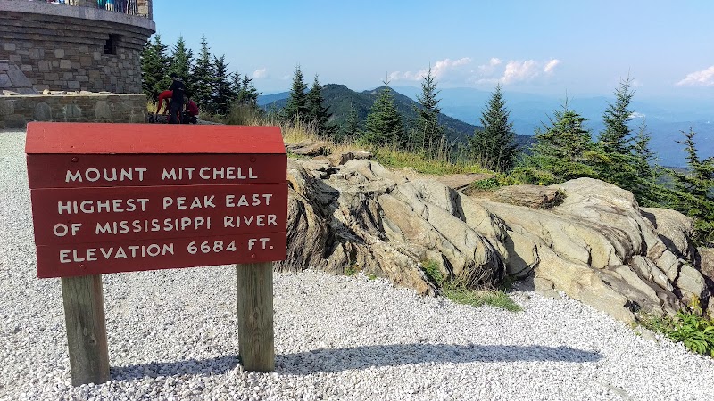
The Mount Mitchell Summit Trail isn’t just a hike; it’s an encounter with the heavens. Rising 6,684 feet above sea level, Mount Mitchell stands as the highest peak east of the Mississippi River, and its summit trail offers adventurers a direct route to its celestial crown. A modestly steep 0.6-mile round-trip journey, this hike packs a punch of grandeur that’s anything but ordinary.
The trail begins at the summit parking area within Mount Mitchell State Park, where crisp mountain air greets you, laced with the scent of spruce and fir. The path is paved but surrounded by wild beauty, as towering evergreens and lichen-covered boulders stand sentinel along the way. Though short, the trail climbs steadily, your footsteps echoing the determination of explorers past who sought to measure these peaks by hand.
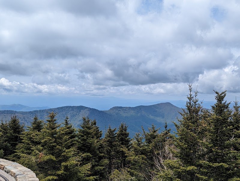
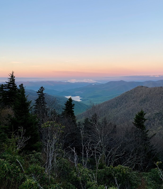
At the summit, the world seems to stretch infinitely in every direction. On clear days, you’ll see an ocean of ridges rolling toward the horizon, their hues shifting from deep green to misty blue. Interpretive signs provide glimpses into the mountain’s unique ecology and history, from its designation as the first state park in North Carolina to its namesake, Elisha Mitchell, who perished while confirming its height in the 19th century.
Mount Mitchell’s summit doesn’t just demand your presence—it earns your reverence. The sheer scale of the Appalachians humbles even the most seasoned adventurer, offering a reminder that nature’s majesty exists both above and beneath our everyday lives. Whether you ascend for the views, the history, or just to say you’ve stood atop the East’s tallest point, this trail is a must-hike pilgrimage for any outdoor enthusiast.
Adventure Guide: Mount Mitchell Summit Trail
Trail Overview
- Length: 0.6 miles round-trip
- Elevation Gain: Approximately 150 feet
- Difficulty: Easy to moderate
- Location: Mount Mitchell State Park, near Burnsville, NC
- Best Time to Visit: May to October for clear weather and full park access
What to Expect
- Trail Features: The Summit Trail is paved and well-maintained, making it accessible to most hikers. Surrounded by Fraser firs, wildflowers, and occasional glimpses of wildlife, the short climb is as scenic as it is manageable.
- Highlights:
- The highest point east of the Mississippi River with panoramic views of the surrounding Black Mountains.
- Historical markers about Elisha Mitchell and the mountain’s designation as North Carolina’s first state park.
- An observation deck at the summit with interpretive signage about local ecology and geology.
Tips for Hikers
- Parking: Ample parking is available at the trailhead near the summit area. However, weekends during peak season can be busy, so plan to arrive early.
- What to Bring:
- A jacket—the high altitude often means cooler temperatures, even in summer.
- Binoculars for birdwatching or catching a closer look at the ridges in the distance.
- Water and snacks for the summit.
- Safety Note: Weather can change rapidly at this elevation. Be prepared for sudden rain or fog, and check conditions before heading out.
Getting There
From Asheville, take I-26 West to Exit 9 for US-19E toward Burnsville. Continue for approximately 19 miles, then follow NC-80 to the Blue Ridge Parkway. Exit at milepost 355 onto NC-128, which leads directly to Mount Mitchell State Park. The summit parking area is clearly marked. Travel time is roughly 1 hour from downtown Asheville.
Fun Fact
Mount Mitchell was named after Elisha Mitchell, a geologist who tragically died in 1857 while measuring its height. His grave is located at the summit, making this trail both a natural and historical landmark.
Visitor Tips:
- Best Times: Spring and Fall for cooler temperatures and amazing lighting.
- What to Bring: Water, sunscreen, and a camera!
Ratings
Overall
9.8/10User rating
Experience Level
Easy
Experience Needed: This natural landmark is recommended for those with minimal outdoor experience. Perfect for families and beginners.