Backpacking the Ozark Highlands Trail
Backpacking the Ozark Highlands Trail
Category
Backpacking
Typical Duration
1 hour
Difficulty
Hard
Nearby Experts
Photo Gallery
Backpacking the Ozark Highlands Trail - Lake Fort Smith Visitor Center
Backpacking the Ozark Highlands Trail - Lake Fort Smith Visitor Center

Backpacking the Ozark Highlands Trail - Lake Fort Smith Visitor Center
About This Landmark
Backpacking the Ozark Highlands Trail
The Ozark Highlands Trail (OHT), beginning near the Western Trailhead in Arkansas, offers an immersive backpacking journey in one of the most scenic regions of the Ozark Mountains. Stretching across over 165 miles, the OHT is renowned for its rugged beauty, diverse ecosystems, and challenging terrain, making it a premier destination for seasoned backpackers and outdoor enthusiasts. Western Trailhead serves as a critical starting or ending point for adventurers, providing access to dense forests, rolling hills, and pristine streams unique to this part of the Natural State.
Adventure Guide to Backpacking the Ozark Highlands Trail
-
Western Trailhead Starting Point
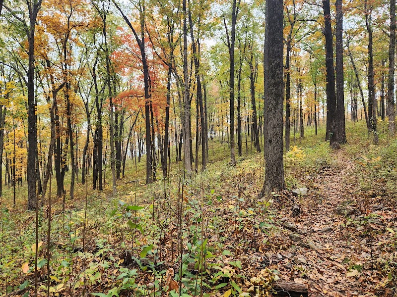
Located near Lake Fort Smith State Park, the Western Trailhead marks the beginning of the OHT. The trail here features steep inclines and rich biodiversity. Hikers will encounter lush hardwood forests, small cascading waterfalls, and rocky outcrops offering sweeping views of the Boston Mountains. The trail transitions quickly between shaded valleys and exposed ridgelines, making it ideal for those seeking variety.
Key Features: Ample parking at Lake Fort Smith State Park, equipped with restrooms and potable water access. -
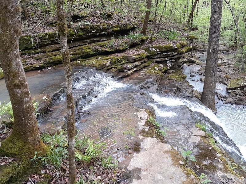
Hurricane Creek Crossing
About 30 miles east of the Western Trailhead lies Hurricane Creek, an iconic OHT feature. This section rewards hikers with crystal-clear waters surrounded by towering bluffs. It's a popular spot to set up camp, providing a tranquil setting to relax after a strenuous day. Though visually stunning, Hurricane Creek can have strong currents depending on rainfall—exercise caution when crossing.
Key Features: Picturesque campsite areas nearby and water filtration opportunities. -
Whitaker Point Connector (Optional Spur Trail)
While not officially part of the OHT, backpackers can opt for a detour to Whitaker Point (Hawksbill Crag). This strikingly beautiful overlook is perfect for a restorative side trip, offering breathtaking views of the Ozarks and making for a memorable photo spot.
Key Features: Iconic views and moderate trail difficulty.
Local Insights
- The OHT is home to species like the black bear and white-tailed deer. Practice Leave No Trace principles to minimize impact on wildlife.
- This trail has historic roots, once used by settlers and Native American tribes, reminding hikers of its cultural significance.
Visitor Tips
- Best Time to Visit: Late fall (October–November) for cooler weather and vibrant foliage.
- What to Bring: Waterproof footwear, lightweight tent, bear-proof food canister, and a detailed trail map. Cell service is unreliable.
- Getting There: From Fayetteville, drive south on I-49 to Mountainburg, then follow signs to Lake Fort Smith State Park (about 1 hour).
- Best Times: Fall for cooler temperatures and amazing lighting.
- What to Bring: Water, sunscreen, and a camera!
Ratings
Overall
Photography
Featured Activities
Primary Activity
Backpacking
Also Great For
Essential Information
Nearby City
Mountainburg, Arkansas
Protected Areas
Lake Fort Smith State Park, Ozark National Forest
Experience Level
Experience Needed: This natural landmark is recommended for those with significant outdoor experience. Best for experienced adventurers.