Skip to main content
Hiking Finger Rock Trail in Tucson
Explore the challenging Finger Rock Trail near Tucson, AZ, spanning 5.5 miles round trip. Rated hard, it offers stunning views and abundant desert flora and fauna. Ideal for seasoned hikers looking for adventure.
Finger Rock Trail
•8.2/10
•Hard
Hiking Finger Rock Trail in Tucson
Category
Hiking
Typical Duration
25 minutes
Difficulty
Hard
Photo Gallery
Hiking Finger Rock Trail in Tucson - Finger Rock Trail
Hiking Finger Rock Trail in Tucson - Finger Rock Trail
Hiking Finger Rock Trail in Tucson - Finger Rock Trail
About This Landmark
Hiking Finger Rock Trail in Tucson
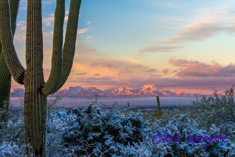
Hiking Finger Rock Trail, located in the scenic Santa Catalina Mountains near Tucson, Arizona, is a challenging yet rewarding adventure for hiking enthusiasts. This rugged trail offers breathtaking views, diverse desert flora, and the opportunity to immerse yourself in the beauty of Tucson’s unique Sonoran Desert landscape. Known for its iconic Finger Rock formation—a tall rock spire resembling an upraised finger—this trail provides a glimpse into the geological wonders and biodiversity that define the region.
Adventure Guide to Hiking Finger Rock Trail
-
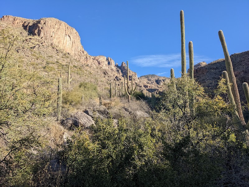
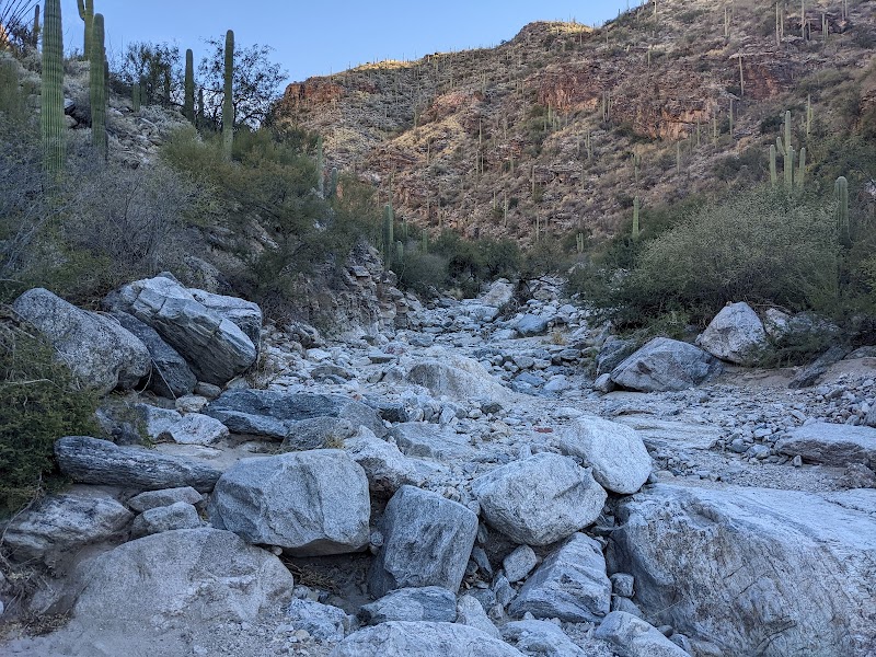
Trail Overview: The Finger Rock Trailhead is located at the north end of Alvernon Way, approximately a 25-minute drive from downtown Tucson. The out-and-back trail spans about 5.5 miles round trip (to the saddle) with an elevation gain of over 4,000 feet, making it a strenuous hike suitable for experienced hikers. The trail traverses steep, rocky switchbacks with awe-inspiring views of Tucson along the way.
-
Key Scenic Points: As you ascend, you’ll encounter striking views of Finger Rock and sweeping panoramas of the Tucson valley below. Keep an eye out for blooming ocotillos, vibrant saguaro cacti, and diverse desert wildlife, including roadrunners and desert lizards. In spring, colorful wildflowers make this trail even more picturesque. The saddle rewards hikers with a stunning vantage point that’s perfect for a quick rest and some photos.
-
Unique Features: Unlike many trails in the region, Finger Rock Trail challenges visitors with its steep gradient and rugged terrain. This makes it a favorite among locals who appreciate its exhilarating workout paired with its unmatched scenery.
Local Insights
-
Cultural Context: The trail’s name comes from the naturally sculpted Finger Rock formation, a landmark visible from various points in Tucson. This formation has become synonymous with the area's hiking culture.
-
Wildlife Tip: Be cautious of rattlesnakes in warmer months and always stick to designated paths to preserve the delicate ecosystem.
Visitor Tips
- When to Go: Early mornings during the cooler months (October–April) are best to avoid extreme heat.
- What to Bring: Plenty of water, sturdy shoes, trekking poles, sunscreen, and snacks.
- Directions: From downtown Tucson, follow Alvernon Way north for 8 miles until it ends at the trailhead (approx. 25 minutes).
Visitor Tips:
- Best Times: Spring for cooler temperatures and amazing lighting.
- What to Bring: Water, sunscreen, and a camera!
Ratings
Overall
8.2/10User rating
Photography
8.0/10Scenic value
Featured Activities
Primary Activity
Hiking
Also Great For
Essential Information
Nearby City
Tucson, Arizona
Protected Areas
Santa Catalina Mountains
Experience Level
Hard
Experience Needed: This natural landmark is recommended for those with significant outdoor experience. Best for experienced adventurers.