Skip to main content
Hiking the Walls of Jericho Trail in Near Hytop
Near Hytop
•9.8/10
•Hard
Hiking the Walls of Jericho Trail in Near Hytop
Category
Natural Landmark
Typical Duration
1 hour
Difficulty
Hard
Photo Gallery
Hiking the Walls of Jericho Trail in Near Hytop - Near Hytop
Hiking the Walls of Jericho Trail in Near Hytop - Near Hytop
Hiking the Walls of Jericho Trail in Near Hytop - Near Hytop
About This Landmark
Hiking the Walls of Jericho Trail in Near Hytop
Introductory Overview
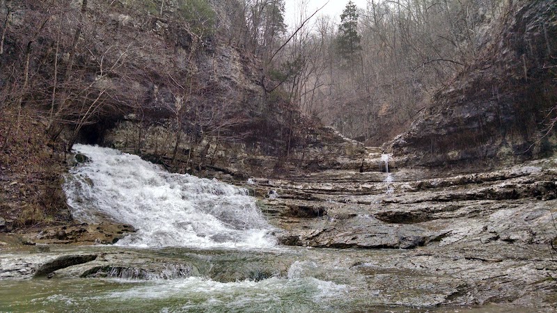
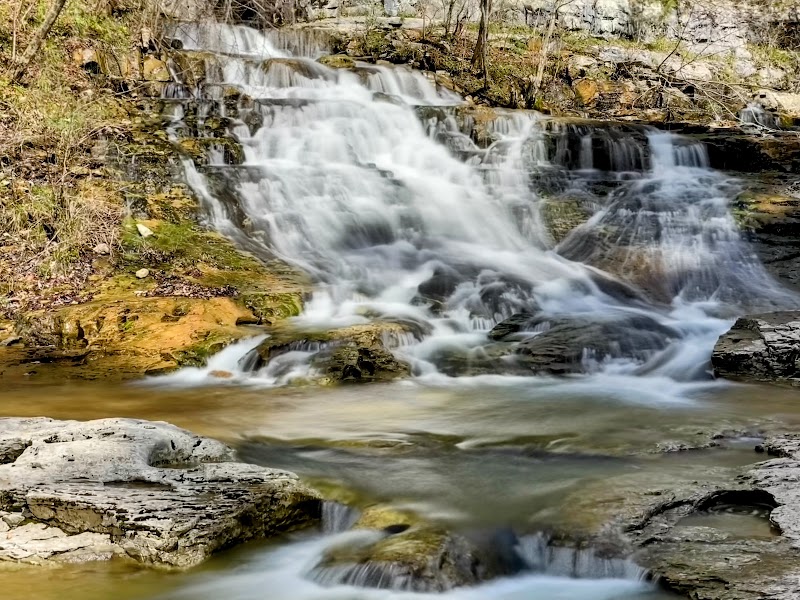
The Walls of Jericho Trail near Hytop, Alabama, is a challenging yet rewarding hike known for its rugged terrain, scenic beauty, and historical significance. This 6.6-mile out-and-back trail descends into a stunning limestone gorge, leading to a breathtaking natural amphitheater with waterfalls and rock formations. With a 1,500-foot elevation change, it requires endurance but offers spectacular views and unspoiled wilderness, making it a top choice for serious hikers.
### Adventure Guide To Hiking the Walls of Jericho Trail
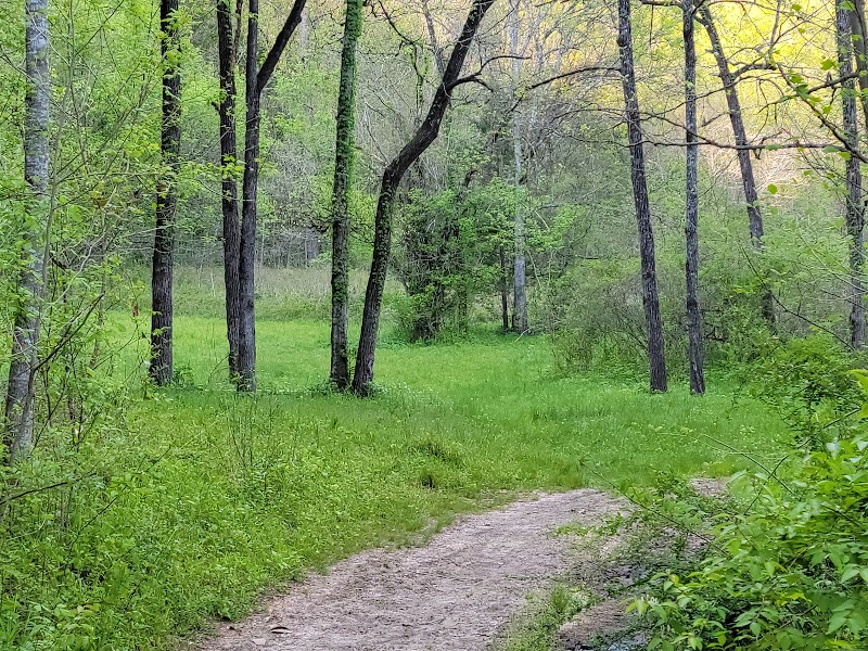
Trailhead and Difficulty Level
- Location: The main trailhead is off Highway 79, about 25 miles south of Winchester, Tennessee.
- Difficulty: Rated strenuous due to the steep descent and ascent, requiring physical preparation. It is recommended for experienced hikers or those comfortable with elevation changes.
- Key Features: Thick forests, river crossings, and a 360-degree panoramic view near the gorge entrance.
Scenic Highlights at the Bottom
- The Amphitheater: A naturally carved limestone formation where flowing water cascades over rocks, creating multiple waterfalls during wetter months.
- Hidden Caves: Several small cave openings can be spotted near the final section of the trail, adding an element of exploration for adventurers.
- Wildlife Spotting: Frequent sightings of white-tailed deer, salamanders, and turkey vultures along the route.
Crossing Hurricane Creek
- At approximately 2 miles, hikers must cross Hurricane Creek—water levels vary depending on recent rainfall, and waterproof boots are advisable.
- Winter and early spring provide the best waterfall flow, but footing can be slippery.
### Local Insights
- Named the "Grand Canyon of the South", this area was historically used by Indigenous peoples and early settlers for hunting and travel.
- The Nature Conservancy acquired this land for conservation, preserving its ecological significance.
- The area was once used for moonshining operations, with remnants of old structures occasionally visible along the creek.
### Visitor Tips
- Best Time to Visit: Fall and spring offer the most comfortable hiking conditions with vibrant foliage. Avoid summer afternoons, as heat and humidity can be overwhelming.
- What to Bring:
- Sturdy hiking boots (due to rocky inclines).
- 2+ liters of water per person.
- Trekking poles for stability on steep sections.
- Bug repellent and tick protection in warmer months.
- Driving Directions: From Huntsville, Alabama, take US-72 W to AL-65 N, then turn onto Highway 79. Estimated driving time is 1 hour 15 minutes.
Visitor Tips:
- Best Times: Spring and Fall for cooler temperatures and amazing lighting.
- What to Bring: Water, sunscreen, and a camera!
Ratings
Overall
9.8/10User rating
Experience Level
Hard
Experience Needed: This natural landmark is recommended for those with significant outdoor experience. Best for experienced adventurers.