Southern Nantahala Wilderness
Southern Nantahala Wilderness offers an unspoiled expanse of forested mountains, cascading streams, and remote trails ideal for backcountry exploration.
About Southern Nantahala Wilderness
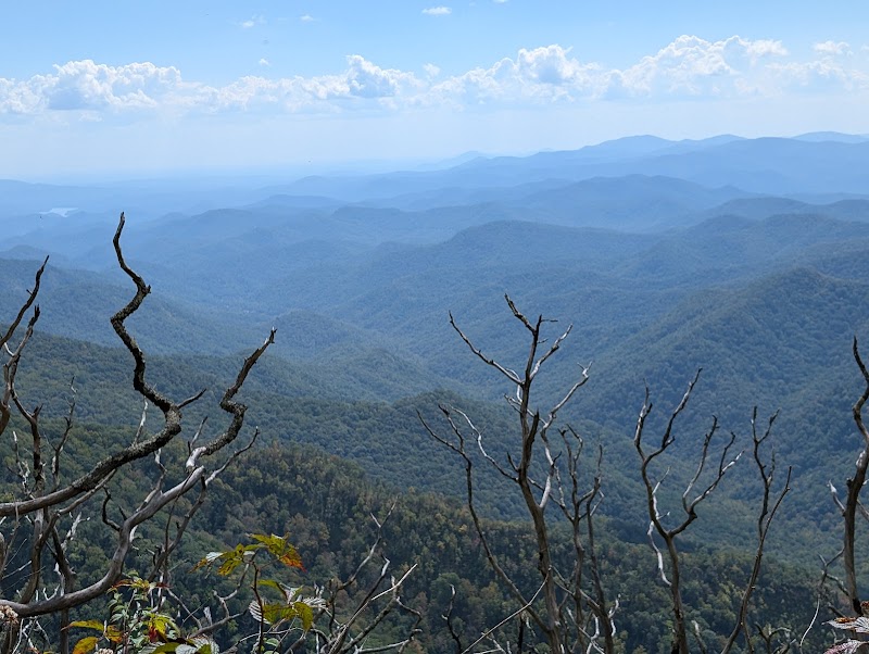
The Southern Nantahala Wilderness, straddling the North Carolina and Georgia border, encompasses over 23,000 acres of rugged terrain. This protected wilderness is part of the Nantahala National Forest and features elevations ranging from 2,400 to over 5,000 feet at its peak, Standing Indian Mountain. Originally designated as a wilderness area in 1984, it is marked by its dense hardwood forests, rhododendron thickets, and numerous creeks that feed into the Nantahala River. The land offers prime habitats for black bears, deer, and diverse bird species. Hikers can explore several prominent trails, including portions of the famed Appalachian Trail, which runs near its border. Because it's primarily managed for conservation, visitors will find few facilities or developed paths and must rely on wayfinding skills. The wilderness appeal lies in its solitude and the opportunity to experience nature in a pristine state.
Highlights
The scenic Bald Ridge, offering panoramic views of the surrounding mountains
The diverse ecosystems supporting a variety of wildlife like black bears and songbirds
Patience Park Trail, known for its challenging inclines and sweeping vistas
The hidden waterfalls along the Kimsey Creek Trail, inviting exploration
Notable Natural Features
Standing Indian Mountain
The highest peak within the wilderness and a notable point on the Appalachian Trail.
Kimsey Creek
A picturesque creek that runs through the area, providing excellent fishing spots.
Bald Ridge
A scenic area offering breathtaking views of the surrounding wilderness area.