Ellicott Rock Wilderness Area
Ellicott Rock Wilderness Area spans across three states and offers secluded hiking, fishing, and wildlife viewing opportunities amidst dense forests and rugged landscapes.
About Ellicott Rock Wilderness Area
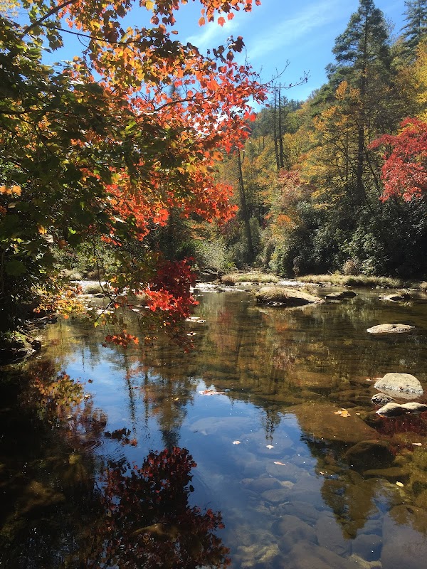
The Ellicott Rock Wilderness Area, covering over 8,274 acres, is a pristine wilderness straddling the corners of South Carolina, North Carolina, and Georgia in the southern Appalachian Mountains. It was designated a Wilderness Area in 1975, emphasizing the preservation of its natural beauty and ecological integrity. The area is distinctive for its rich biodiversity, including diverse flora and fauna such as black bears, white-tailed deer, and numerous bird species. The Chattooga River, a National Wild and Scenic River, provides a natural boundary and is a popular spot for fishing and whitewater activities. Historically, Ellicott Rock marks the boundary set in the 1811 survey by Andrew Ellicott, a notable feature for history enthusiasts. The wilderness offers a range of hiking trails such as the Ellicott Rock Trail and the Bad Creek Trail, allowing visitors to explore its lush forests and challenging terrains. The remote nature of the wilderness ensures a peaceful retreat for avid hikers, campers, and wildlife photographers seeking solitude in a largely undeveloped setting.
Highlights
Ellicott Rock - The historical boundary marker with significance dating back to 1811.
Chattooga River - Renowned for its whitewater rafting adventures and scenic beauty.
Diverse Ecosystem - Home to diverse wildlife, including black bears and rare bird species.
Solitude and Seclusion - Offers remote hiking and camping away from crowded areas.
Notable Natural Features
Ellicott Rock
A historical marker indicating the point where North Carolina, South Carolina, and Georgia meet.
Chattooga River
A designated Wild and Scenic River known for its challenging rapids and scenic vistas.
Laurel Fork Falls
A cascading waterfall accessible via remote hiking trails, offering picturesque views and serene surroundings.