Potash Road Scenic Byway
The Potash Road Scenic Byway is a stunning drive along the Colorado River, offering breathtaking views and a gateway to some of Utah's most iconic rock formations.
About Potash Road Scenic Byway
Potash Road Scenic Byway, also known as Utah State Route 279, stretches for approximately 17 miles along the western edge of Canyonlands National Park, closely following the Colorado River. It provides adventurers with scenic views of towering red rock cliffs, ancient petroglyphs etched by Native Americans, and unique rock formations such as the famous 'Coronation of King George'. The road not only serves as a passage for enjoying the dramatic beauty of the desert landscape but is also a popular access route for rock climbing enthusiasts seeking to tackle the challenging cliffs. Besides geological wonders, visitors can also witness remnants of mining operations on this road, remnants of the potash industry that gave the road its name. The drive culminates in a breathtaking view of the river and surrounding canyons, often traveled by those visiting the Dead Horse Point State Park or heading to the White Rim Trail.
Highlights
Shafer Canyon Overlook offers awe-inspiring views of Canyonlands.
Dinosaur Tracks visible in the rocks right off the road.
Intrepid Potash Plant provides a glimpse into the mining history of the area.
Ample rock climbing opportunities on the challenging Wingate cliffs.
Notable Natural Features
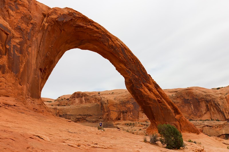
Corona Arch
A natural arch formation near the byway that offers an iconic photo opportunity.
Jug Handle Arch
A uniquely shaped arch resembling a jug handle, easily visible from the road.
Petroglyph Panels
Ancient petroglyphs carved by indigenous people, visible along the cliffs.