Ice Age National Scenic Trail
The Ice Age National Scenic Trail traces the edge of the last glaciation in Wisconsin, offering hikers a path through scenic landscapes shaped by ancient ice movements.
About Ice Age National Scenic Trail
The Ice Age National Scenic Trail is a sprawling footpath tracing over 1,200 miles through the diverse landscapes of Wisconsin. It showcases the dramatic geographical features sculpted by glaciation during the last Ice Age, such as kettles, kames, and moraines. The Trail meanders through a blend of public and private lands, including state parks, forests, and wildlife areas. It serves as a natural corridor connecting unique ecosystems, from boreal-like forests in the north to rolling prairies and hardwood forests in the south. Established in 1980, it offers a remarkable opportunity for hikers to witness a range of Wisconsin’s natural beauty while learning about its glacial past. Key landmarks along the trail include the Devil's Lake State Park known for its striking quartzite bluffs, and the Kettle Moraine State Forest, showcasing classic glacial formations. The trail not only attracts recreational enthusiasts but also serves as an educational avenue for understanding glacial geology.
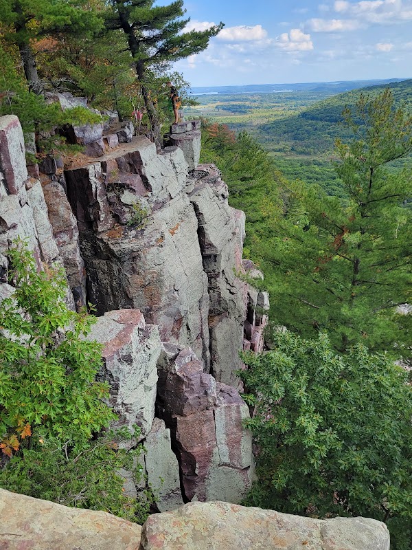
Highlights
Devil's Lake State Park with its towering bluffs and tranquil lake.
The scenic and ecologically diverse Kettle Moraine State Forest.
The expansive views from the scenic overlook at Gibraltar Rock.
The Dells of the Eau Claire River's fascinating geological formations.
Notable Natural Features
Kettle Moraine
This unique feature is a hallmark of glacial geology with rolling hills and depressions created by retreating glaciers.
Devil's Lake
The area's impressive quartzite bluffs present challenging hikes and spectacular views.
Gibraltar Rock
Offers one of the most beautiful panoramas of the surrounding landscape, especially during sunset.