Santa Catalina Mountains
The Santa Catalina Mountains rise dramatically just north of Tucson, Arizona, offering diverse ecosystems from saguaro-filled deserts to pine-clad summits.
About Santa Catalina Mountains
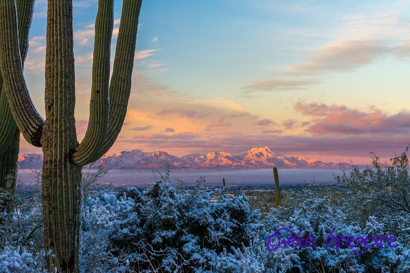
The Santa Catalina Mountains are a prominent mountain range located in southern Arizona, forming part of the Coronado National Forest. They are known for their striking elevation change from desert terrains at the base to alpine forests near the peaks. Mount Lemmon, the highest peak at 9,157 feet, is a focal point for year-round recreation, attracting visitors with hiking, rock climbing, and skiing in the winter. These mountains have a rich ecological diversity due in part to the significant elevation gradients. Visitors can explore habitats ranging from desert to forest, encountering wildlife such as black bears, deer, and various bird species. Historically, the area has been significant for Native American tribes and early American settlers. Today, the Catalina Highway provides a scenic drive from the desert floor to Mount Lemmon, passing through multiple climate zones and offering numerous opportunities for outdoor activities including hiking, biking, and rock climbing.
Highlights
Mount Lemmon, the highest peak offering panoramic views and seasonal snow activities.
Diverse ecosystems allowing visitors to experience desert, forest, and alpine environments.
Catalina Highway, a scenic byway showcasing the mountain's elevation changes and natural beauty.
Pusch Ridge Wilderness, known for its rugged terrain and opportunities for backcountry hiking.
Notable Natural Features
Mount Lemmon
The highest point in the range at 9,157 feet, popular for its observatory and ski area.
Sabino Canyon
A stunning canyon offering tram rides and access to numerous hiking trails.
Biosphere 2
Located near the base, this facility is a unique Earth systems science research center.